SHARE


 Malawi
17-11-2016 | di COOPI
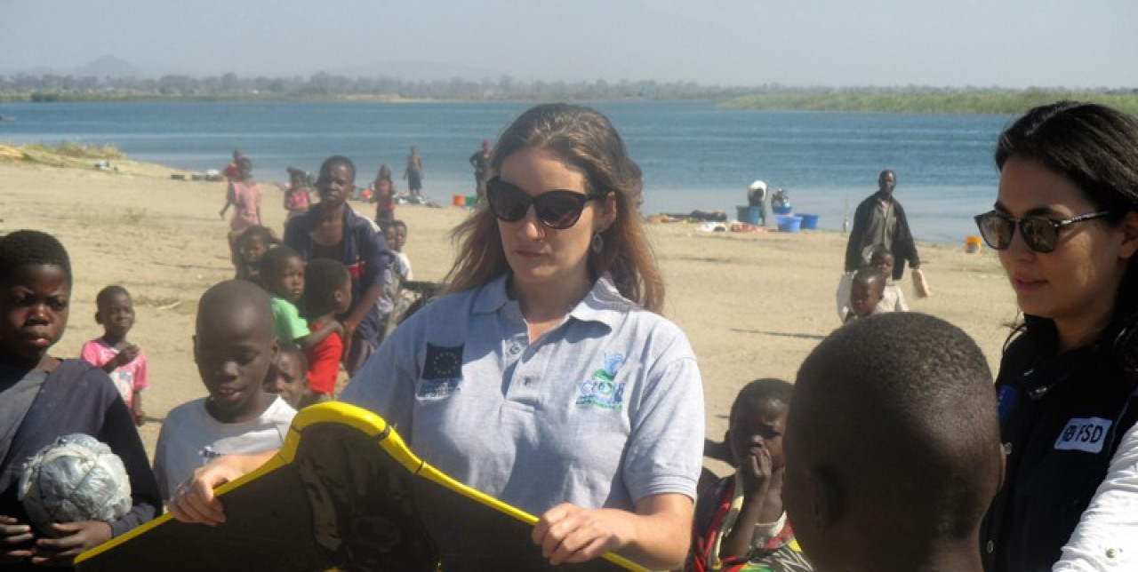
Malawi: drones can help saving lives
In Malawi, drones can help saving lives. In the Traditional Authorities (T/A) Mponda and Namabvi (South of the large Lake Malawi), during the months of August and November 2016, COOPI Malawi received the grateful visit of Fondation Suisse de Déminage (FSD) who is leading the project "Drones in Humanitarian Action" thanks to the funds of the European Commission's Humanitarian Aid Department (ECHO). COOPI is currently implementing an ECHO funded Action "Strengthening emergency preparedness and resilience of hazard-exposed communities in Salima and Mangochi Districts", and the FSD intervention could complement COOPI's activities in Mangochi District, Malawi Southern Region.
As of early 2016, Malawi has been experiencing the worst food insecurity in over a decade with 6.5 million facing food insecurity up to date. Prolonged droughts have led to crop failures and are responsible for current food shortages. In addition, floods have occurred early 2016 and are expected later in the year during the rainy season, compounded by a strong La Nina effect.
Reinforcing emergency preparedness
The action of COOPI in this context aims at reinforcing emergency preparedness and livelihood protection capacities of vulnerable communities, with the purpose of enhancing their resilience to climate-induced food insecurity. COOPI is working hand by hand with vulnerable communities of the target areas to improve their resilience and also with the Local Authorities to increase their knowledge and their capabilities to face the disasters that continuously affected a population that has poor and/or very poor incomes.
Unmanned Aerial Vehicles method
Traditional methods of drought assessment and monitoring rely on rainfall data. However, this approach has two main disadvantages: rainfall data is limited in the region, and they are often inaccurate and difficult to obtain in near-real time. In contrast, UAVs (Unmanned Aerial Vehicles) can be deployed rapidly to provide the data.

The main objective of the visits was to determine if the use of UAVs could bring more efficiency in terms of time spent for conducting hazard assessments and facilitate community participation in mapping exercises and deliver information that can improve decision-making.
During its second visit in November, FSD was able to map 50 km2 in 46 flights during 4 days. The exercise looked very important to local communities and other stakeholders (government and NGOs) because when disaster strikes, quick and accurate data is needed. This can support the rapid assessment of disaster affected areas which can also help in providing rapid response. By flying over an affected area, drones can provide a virtually instant overview of disaster damage and potential needs-safety able to address the logistical needs that always arise whenever there are floods. The drone technology can play a vital role in local capacity building, empowering communities by giving them immediate and easy access to relevant data that can be used for planning of the District Development activities and that can save lives.
COOPI wants to thank FSD and ECHO for this demonstration, and the Local Authorities of Mangochi (at District Level and in particular Mponda and Namabvi T/A) to welcome the activity and support our interventions!
Article written by Giulia Tieni